Categories
Short Rides

Day 06 – Dalbeattie to Creebridge

Another beautiful morning! Dalbeattie was quiet as I left. The breeze so gentle, it felt as if I had a headwind in all directions.

I diverted to see Orchardton Tower. It was well worth the extra mile.Down the road at Dundrennan, a wicker figure stood guard on what must be the site of the famous former Wicker Man festival.The coastal ride was stunning. I could feel the heat of the sun deepening my odd, one-sided tan. It wasn’t long before I was tucking into a cheese scone at the very popular Mulberries in Kirkudbright (“Keer-coo-brie”).Talk of the town was that the bridge is closed. Years of heavy vehicles using the  100-year-old reinforced concrete structure means it can’t safely hold even cars anymore. The closure is only two months old. Footfall and takings are down at the shops, apparently. I checked out my detour distance (6 miles) before asking if the bridge is open to pedestrians. It is!The quality of the road surface was awful today. So awful that one of the smoothest consistent sections was a forest track that route 7 followed to avoid riders using the A75 on the way into Gatehouse of Fleet.Gatehouse was lovely. I started to think about accommodation for the evening while I was drinking my coffee in the afternoon sunshine.

There is no coastal route from Gatehouse to Newton Stewart that doesn’t use the A75 and I don’t have a deathwish. That meant following route 7 over the old military road. The bump on the ride profile looked significant. It was to these legs. I kept telling myself it’s a longer andd shallower climb to the same height as a climb I do regularly at home.

I was slow. There were logging trucks to avoid. And I saw a pine Marten. I saw a pine marten! I had to describe it to Gemini to identify it. And that’s what it was. The description said they are ‘often elusive’. I adore these moments on my bike.

Reaching the top of the, military road, I was looking forward to a lovely long roll downhill. It was a necessarily slow shake, rattle and roll. The pitted and potted road surface made me long for that forest track again.

Avoiding the A75 meant a climb up to another fabulous former railway line. Then a very steep climb through a forest on the old military road. I kept telling myself that it was similar to the hill through the village I live in. Then I tld myself that this afternoon I’d have been walking up that too.

I finished the day on the dedicated cycleway alongside the A75 into Creebridge.

Day total: 57 miles, 2988ft climbed

Tour total: 388 miles,  14,424ft climbed

Categories
Short Rides

Day 05 – Carlisle to Dalbeattie

There was a chill in the air as I cycled down to the River Eden to have a look at Carlisle and start the day’s riding.

At 11am, 275 miles into my trip, I crossed the England Scotland border and stopped in Gretna for a break to eat the ginger cake my host had given me as I left this morning. The sun was out, the views were glorious and the wind was with me. I stopped at the Devil’s Porridge Museum (go, it’s great) and motored on to Annan.Route 7 stopped and started. I saw several “END OF ROUTE” signs as the country lanes joined a designated B Road. One warned me that the road was busy. It was long and straight and some of the drivers were in a hurry. It wasn’t busy.

Route 7 hugged the coast and Caerlaverlock Castle arrived 300 miles into my journey. I stopped for a look round and a stretch on the grass in the sunshine.Dumfries came late in he day, still bathed in glorious sunshine. I had had no lunch, so I found a cafe for a snack, then crossed river on the Old Bridge. I’ve long wanted to see it up close. (I know, bridge geek).

Leaving Dumfries at 5pm, I chose to avoid A roads and followed Route 7 westwards. That meant hills and inland views.

All the climbing in the day was in this bit. I didn’t look at how far I had to go. I didn’t look at the elevation profile. I just kept pedalling. Mostly slowly.

At Haugh of Urr, I turned to follow the river down to the estuary. It should have been all downhill. It wasn’t. Happily Dalbeattie turned up just as I was ready to finish the day.

Day total: 69 miles,  2,307ft climbed

Tour total: 331 miles,  11,436ft climbed


Categories
Short Rides

Day 04 – St Bees to Carlisle

I was rudely awoken by the climb ot of St Bees. Staying in coastal village is a great idea. At the end of a long day’s cycling, there’s a nice roll downhill. I certainly wasn’t complaining last night. This morning, I’m paying the price. It’s warm and the wind is with me. Sweat is already dripping off my nose. I’ll travel 70 miles today and half the climbing is in the first two miles. I’m kept amused by thinking back to a guy I’d met briefly at one of the vllage’s information boards this morning. “I’d expected this place to be a proper shit’ole,” he announced. He followed quickly with, “but it isn’t, mate. It isn’t” The village council should immediately adopt this declaration as its tourism campaign slogan and appoint this man as chair of Visit St Bees.

Whitehaven glistened i the morning sunshine. It was quiet on the seafront. A few people queuing around the C2C sign with their bikes. I waited and took a photo.

Route 72 followed the coast to Lowes, then climbed to another old railway line that took me to Workington.

I hit 300 miles for the trip as I arrived at Newlands cycles. I had phoned ahead and Mark was expecting me. An hour later I was enjoying a riding experience that didn’t include a squeaking and sticking front brake.

Riding out of Workington, I was looking at the way sign and looking at the map trying to work out which way to go when a guy in a Sustrans jacket came over and reorganised the pointers. Suddenly they made sense. Andy has looked after these cycleways for Sustrans for 20 years. He told me he looks after as far as Newton Stewart, so I’ll be seeing his work for at least two more days.

It was warm riding up to Maryport. I had lunch at the aquarium cafe and headed northward again.

The wind was with me for the first time this trip and I was enjoying it. Route 72 switched between dedicated tarac strips through the dunes, and on-road sections. A couple of times it headed inland. The first time, I fllowed it. Then I just stuck to the coast road. I had a lovely chat with another tourer who is celebrating retirement on the road with only a rough plan and absolutly no timescale. The sense of freedom that must bring!


The road kept rolling under my tyres and I found myself i nthe cobbled streets of Silloth. The village shone in the afternoon sunshine. I could see right across the Solway to tomorrow’s ride.


The riding got tougher as I headed west into the wind to round Bowness Common in the far north west of Cumbria. With the wind at my back I pushed on along the cast to Carlisle, stopping only for a rural traffic jam and quick coffee as a chance t to recharge my phones.

Day total: 75 miles,  1,848ft climbed

Tour total: 261 miles,  9,129ft climbed

Categories
Short Rides

Day 03 – Walney to St Bees

I started out from Walney and had a little bimble through Barrow-in-Furness to look around town.Outdoor maritime display at the Dock Museum in Barrow-in-Furness, featuring large red and green navigational buoys marked 'PRE' and 'EAST', along with a grey naval missile launcher on a gravel area under a blue sky. Raised beds and an information sign are visible in the foreground, with houses and lamp posts in the background.

First stop was Furness Abbey, which was absolutely delightful in the morning sunshine.

Ruins of Furness Abbey in the morning sunshine, with warm light casting shadows across the well-kept lawn. The large Gothic arches and stone walls of the historic structure stand partially intact, with some sections supported by scaffolding. Surrounded by trees and a bright blue sky with scattered clouds, the abbey exudes a serene, timeless atmosphere.

I climbed up to Dutton and stopped to look at Dutton Castle, which is small and believed to be a former court house. There was a cycleway to Askam-in-Furness: they’ve painted green the bit of tarmac that sits outside the white line on the very fast main road. When I arrived, I headed out to the point and had a look across the water to Millom.

The climb out of Askam was challenging. Barely outpacing pedestrians on the pavement. Certainly going slow enough to have a conversation while I passed. Traffic was light on the A595 and it was enjoyable riding. I was still glad when I reached Kirkby-in-Furness, got off the main road and saw Pam’s Cafe, which is open on Sundays, Mondays and Tuesdays. So I just managed to catch it open.

Pam’s Café in Kirkby-in-Furness, a small stone building with a slate roof and a cosy outdoor seating area. Two customers sit at a table beside a low stone wall, while a bright sign in front reads ‘Pam’s Café – OPEN – Muddy Boots & Dogs Welcome’. The café has rustic charm, with logs stacked neatly by the wall and a mix of sunshine and shade under a partly cloudy blue sky.

Over coffee & a warm-from-the-oven cheese scone,, I got talking to some locals told them where I was headed for the day and asked them about a potential shortcut across a bridal way. They confirmed it would work, so I got a lovely ride out across Dutton Mosses marshlands which was was just stunning. I popped back out on the A595 and turned up into Broughton-In-Furness for lunch at the Square Cafe.Street view of The Square Café in Broughton-in-Furness, Cumbria. The café occupies a pale cream corner building with green-trimmed windows and outdoor seating under colourful parasols. People sit at picnic tables enjoying food and drinks. Bunting decorates the front, and parked cars line the quiet street under a partly cloudy sky.

It was another tough climb out of Broughton. It had a chevron on he map. I was rewarded by a great view and a thunderous ride down the the A595 to a traffic light controlled bridge.

The road climbed ahead and I was so focussed on preparing myself for that that I didn’t notice I should have turned off, so I had a massive climb to do. I just kept plugging away. Plugging away.

At Hill Top, I stopped to look at a beautiful 12th century Church, which was open for VE day. There was nobody around but it was open. And then into Millom I didn’t stop for long. An oncoming driver turned right across me and hit the brakes hard when she noticed 18 stones of cyclist in her way.Bronze-coloured statue of a miner pushing an iron ore wagon, mounted on a brick plinth in a town square in Millom, Cumbria. Behind the statue is a building with a green-domed clock tower and scaffolding, with shops, cars, and overcast skies completing the scene. The statue commemorates the Hodbarrow Miner and the town’s heritage of mining and ironworks, as noted on a plaque below.

I don’t think I would have ridden the A595 on any other day. On a bank holiday Monday afternoon, there was very little traffic about and it was a nice ride. At Bootle, my OS map route encouraged me off the main road and took me up.

A couple of steep climbs in the heat were sweatingly uncomfortable. The views of the mountains and the sea were amazing. It would have been rude not to stop and admire them. I could see four miles and miles. And miles.Quiet country road above Broad Oak in Cumbria, heading north through green fields and rolling hills under a blue sky with scattered clouds. A blue touring bicycle is propped against a stone wall beside a road sign warning of a 20% gradient. Trees line the roadside ahead, and the landscape stretches into wooded hills in the distance.

View of the Lake District mountains taken from the south, with a foreground of green fields, hedgerows, and a narrow country lane. The peaks rise in the distance under a clear blue sky with scattered clouds, with the distinctive shape of Scafell Pike and neighbouring fells visible. Electricity pylons dot the landscape, blending modern infrastructure with natural beauty.

Another massive descent later took me down to Muncaster Bridge. My progress was slowed by another climb up over the top at Muncaster Castle.

After a drink and a little snack at the Ravenglass Inn, I picked up Hadrian’s Cycleway up the coast to Seascale. The coast cycleway at Sellafield has been closed for four years. It’s been washed away at the northern end. Typically, I persevered and found that out only when I reached the northern end. I carried the bike over the tricky bit.

Hadrian’s Cycleway took me nearly to Egremont where I turned off to St Bees. I arrived at The Queen’s more than 10 hours after I left Walney. My longest day so far.

Day totals: 64 miles,  3,253 ft climbing

Tour total: 188 miles,  7,821 ft climbing

Categories
Short Rides

Day 02 – Arnside to Walney

A Union Jack flag flutters on a tall flagpole at the end of a promenade in Arnside, overlooking the estuary. Red, white, and blue bunting is strung along black railings, and benches and bins line the viewing area. The sky is bright blue with scattered clouds, and low hills stretch across the horizon beyond the wide, sandy bay.The bunting was up in Arnside, which obviously meant word of my arrival had got out. Passengers poured off the train as I passed the station on the way out of the village. I briefly thought about jumping on the train to see the viaduct up close. No time for that.  I need to get on.A blue touring bicycle leans against a stone wall on a seafront promenade in Arnside, Cumbria. Behind it, a long viaduct stretches across a wide expanse of sand and shallow water under a bright blue sky dotted with fluffy clouds. Hills and scattered houses are visible in the distance.

Out through Sandside to Milnthorpe Bridge. Sandside lives up to its name—mile-wide estuary a cast expanse of sand. A proper Cumbrian morning: bright, blustery, a hint of chill. At the A6, the sign says “Caution busy road” and what looks like an urban painted-white-line cycle lane isn’t. It disappeared on a bend and I experience my first, involuntary shout and gesticulation-inducing close pass of the trip. Then back to calm, climbing gently into Levens where the view opens out.

A cyclist caught me on the hill outside Meathop. We chatted pleasant cycling talk about the day and our bikes. Hers a road bike, because it makes the hills arond here managable. She told me if I was holding her up, I should cycle on. I was pleased to have company for a few miles. she was holding me on that shit cycle up. She got her first road bike more than a decade ago and hasn’t looked back. She’s been cycling for a while. We talked about the benefits of cycling, being out, enjoying the ride and shared stories of how it has helped us keep on top of our mental wellbeing. I said my goodbyes at Grange over Sands. I had spied a cafe.

Two other cyclists arrived at the cafe at the same time. We sat on neighbouring tables and got chatting waiting for our orders (coffee and flapjack for me) to arrive. They are local musicians who play regularly in the pub I’ll be staying at tonight. They strongly suggested I go to Cartmel and they sold it well as an example of a perfect South Cumbrian village. They told me it was up a very steep hill and knowing my route for the day was relatively flat, I wasn’t keen.The village square in Cartmel, Cumbria, bustling with people under a partly cloudy sky. The Kings Arms pub faces the camera at the far end, with traditional whitewashed buildings and colourful bunting lining the street. Visitors walk and sit outside cafés and shops, including one named ‘Perfect English.’ Parked cars line both sides of the road.

Twenty minutes later, I reached Allithwaite and ssaw a sign for Cartmel 1¾ miles. I decided to go for it. The hill wasn’t too bad. Cartmel was lovely. And tiny. The village square is beautiful. I checked out some of the shops and went to the grounds of the priory for a middle of the day stretch.

From Cartmel, the road rose to Bigland Hall—the highest point of the ride. Brake niggles started here and would keep me company for most of the day. From Bigland Hall the view of the Cumbrian fells was jaw-dropping. I could pick out Scafell Pike. The stop was a chance to chat to a drystone waller about mountains, microclimates and the wisdom of checking contour lines before choosing shortcuts.

The descent was fast and joyful, until Greenodd, where the cycle path turned to gravel and I walked to protect the bike until I’d crossed the river.A narrow pedestrian and cycle bridge with metal railings stretches straight across a tidal river, leading towards green hills and scattered houses in the distance. The sky is bright blue with large white clouds, casting shadows onto the path.

A big climb at Penny Bridge and another glorious view. I looked back across Morecambe Bay, still tracking the distant power station I first saw yesterday. I’d done 30 miles and felt every one of them.

Onward to Ulverston and Bardsea for a slice of tea loaf (rude not to) and a flat coastal stretch through Aldingham and Rampside. The breeze was with me and it was fabulous riding.

Over the causeway to Roa Island. It was wind-whipped, rust-streaked and oddly beautiful. I was too late for the ferry to Piel Island.

On the final stretch into Barrow along a lovely purpose-built cycleway, the authorities had seen fit to install gates clearly designed by people who want to stop motorcyclists using the path. They were a squeeze for me and would be a struggle for any mountain bike rider.

Barrow was quiet an industrial. I arrived on Walney at the end of the Morecambe Bay Cycleway and rode to the south end of Walney before heading to my accommodation.A touring bicycle leans against a large circular metal sculpture marking the Bay Cycle Way on Walney Island, Cumbria. The sculpture resembles a bicycle wheel and includes a map and wave design. Behind it, a shingle beach meets a shimmering sea under a partly cloudy sky, with distant wind turbines visible on the horizon.

Highlights: Conversations, Cartmel detour, Bigland views, Roa Island causeway

Lowlights: That one car near Levens and those ridiculous gates near Barrow

Day 02:  63 miles,  2,479ft gained

Trip total:  125 miles,  3,758ft gained

Categories
Short Rides

Day 01 – Blackpool to Arnside

Blackpool was starting to wake up (it had had a late night) as I made my way to the Tower in the blustering sunshine to to start the day’s riding.

I had to get going quickly, I had a date with a ferry at 9.45 and it was quarter past nine already. Nine flat miles in half an hour. It should be doable. Should be. The headwind had other ideas. Bright skies, lovely views, people on the promenade buttoned up like it was a February morning. It was hard work pushing into the wind. That changed at Rossall Point. Cycling east I was pushed along and I knew I’d make the ferry. The 10.15 ferry, admittedly.

The plan was to hop across the mouh of the Wyre to meet my mate Phil on the other side. It would have been an eight-minute crossing. The sign announced the first crossing would be at 13.45.

A weathered chalkboard sign at the Fleetwood ferry jetty displaying handwritten ferry times: "First - 13:45, Last - 17:45, Every 30 mins." A printed ferry timetable is also pinned to the bottom right corner of the board, all mounted on a black metal fence.

I called Phil to say I’d be late and shot off down the A585 cycle path and through Thornton to cross the river and head back up to Knott End.  I celebrated with my first cake of the trip.A polished metal sculpture of a man and his dog, titled "Matchstick Man and His Dog – LS Lowry," located on the Knott End promenade. The figures face towards the sea, set against a background of modern apartments and a small black shelter. The sculpture marks the spot where the artist LS Lowry sketched scenes of the ferry and coastline in the 1940s and 1950s, which inspired his painting "Jetty at Knott End."

It was gone 11 when we set off together. This part of the country is pancake flat. The wind was with us and we chatted as we rode flying through the Lancashire countryside. A little traffic, but otherwise glorious.

We rolled past Pilling and Cockerham Marsh, up to Glasson Dock where we stopped for coffee (and flapjack). Then onto the Millennium Cycle Way, a great surface winding along the shore all the way into Lancaster. Over the footbridge, and then picked up the dedicated cycle route out to Morecambe.

Morecambe was buzzing. People enjoying the seafront sunshine on a bank holiday weekend. We found a spot for a late lunch and sat chatting in the sunshine. It felt good riding with Phil easy company and easy pace. It was great to have a guide to follow or shout directions.


We split up at Morcambe. Phil to head home, me to continue north around the bay. The Morecambe promenade was a joy and over to soon. Up to Carnforth and onto Route 700, the Silverdale Cycleway. The cycleway meanders gently through nature reserves and woods, The open countryside around Silverdale was a perfect picture of stone walls and large parkland trees. These were my only hills of the day. Two to mention and then only 100ft or so. The second from the shore up past Arnside Tower and it was downhill to Arnside, where I’m staying tonight.


64 miles. 1279ft gained

View of the shoreline at Arnside, Cumbria, at sunset. A row of houses lines the left-hand side along the coast, while calm water reflects the soft orange and pink hues of the sky. Low tide reveals a rocky, sandy beach in the foreground, with gentle hills visible in the distance across the estuary.


Categories
Short Rides

A Right Royal Ride

Glorious weather predicted and the prospect of quiet roads, because of big TV audiences for the Royal wedding. A good reason to be putting on my cycling shoes in Barnard Castle at 8.30 am. The air was still cool down by the Tees and on the road up to Romaldkirk. Up the lanes past Hury and Blackton reservoirs, then over the tops to Grassholme reservoir and out over Mickleton Moor on the road to Brough. The road topped out at 1550ft just after the county border to give me stunning views out over Cumbria to North Yorkshire and the peaks of the Lake District. I dropped into the Eden Valley losing 1,000ft in five miles and rolled through Brough for a cake stop at the Pink Geranium cafe in Kirkby Stephen.

Then climb through Nateby and up over Lamps Moss, a two and a half mile climb averaging 8%, but with stretches much steeper. The signs said 20%. I was caught and passed by several other cyclists. It was such a beautiful day, but I was struggling to catch my breath.

The climb topped out at 1650ft and 32 miles into my ride, I crossed into my third county of the day. Upper Swaledale is glorious. Glorious! And such a joy to ride downhill. I used every advantage gravity can give, but my breathing got worse and a wheeziness became a whistle. By the time I reached Reeth, I was really sruggling. I crawled into the Dales Bike Centre at Fremmington and collapsed on the grass.

Coffee, a good sandwich and an enormous slice of cake later, I thought I was ready to push on, but a mile up the road after climbing and 250ft, I knew my day was done. I had to do something I’ve not done in years: make the call of shame. I called home to be picked up.

It was an excellent ride. Will definitely go back to complete it at some point soon.

50 miles; 4,485ft of hills; 4h 33m in the saddle


Categories
Short Rides

Hamsterley Barney Loop

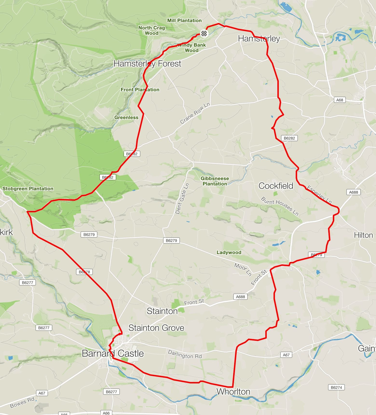
There is little better than being out early in the Durham Dales. Quiet roads, stunning landscapes, and the chance to rub shoulders with our wonderful wildlife. It’s my favourite time of day and there’s no better way to enjoy it than by bike.

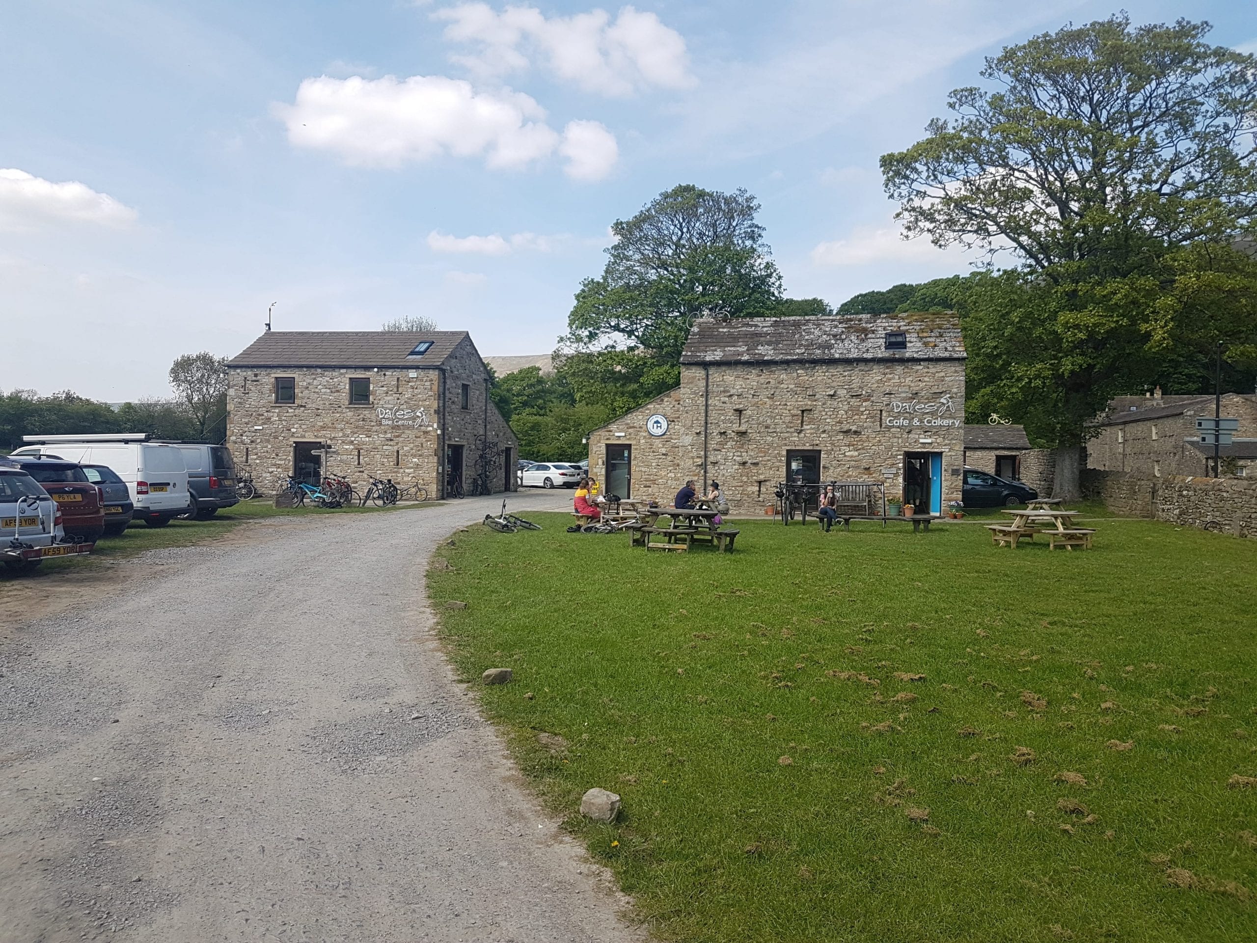
Hamsterley Forest makes an excellent starting point for a ride. There’s plenty of parking and good facilities at the visitor centre. And to get you started the National Cycle Network’s route 70 follows Forest Drive for the better part of five miles’ traffic free riding tracking Bedburn Beck deep into the forest. The forest is full of quietness this morning. It’s just me, a few mountain bikers heading off on the forest trails, the odd dog walker and some squirrels scurrying away as my tyres crunch on the gravel. The challenge of following route 70 is the monumentally steep hill from the forest up to the Woodland road. There’s no shame in walking your bike up the steeper parts.

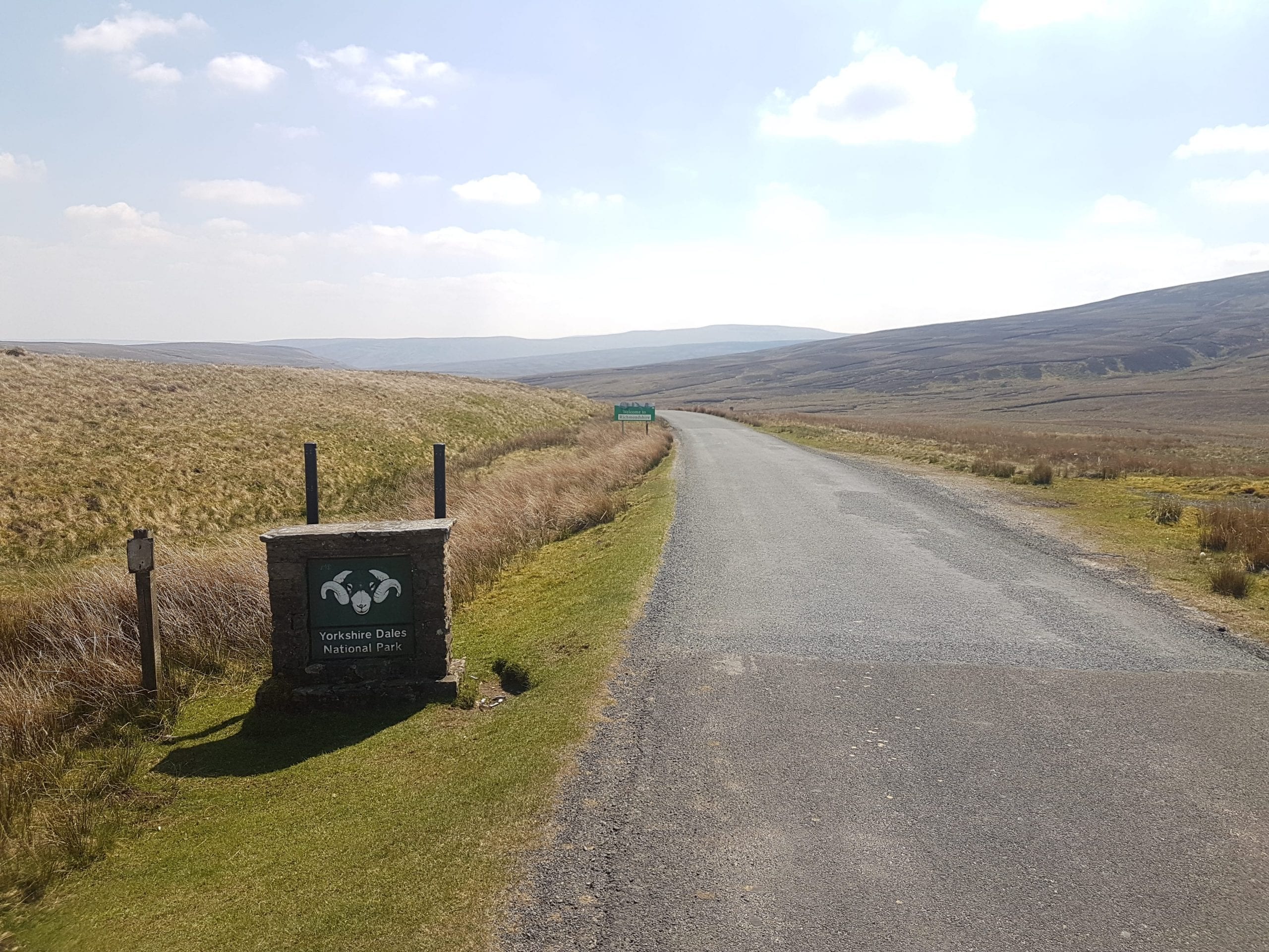
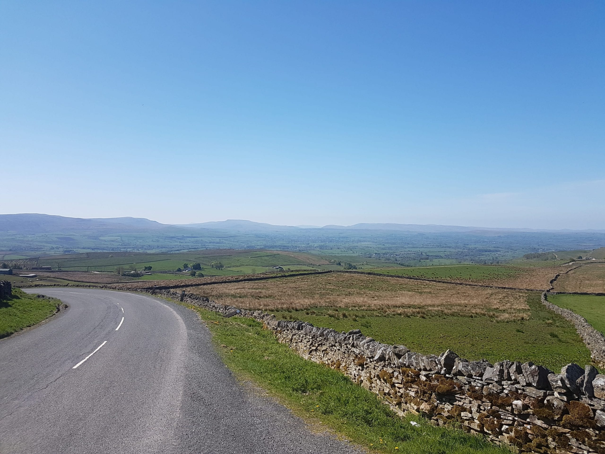
There are spectacular views as route 70 strikes out across the moorland towards Eggleston. On a previous ride I was joined here for a short stretch by a barn owl gliding over the hedgerows in search of breakfast. This morning I’m treated to lapwings peewitting their courtship in the air above me. The official Hamsterley to Barnard Castle cycle route turns to Kinninvie, but I head to the top of Langleydale and get a peak of the high Pennine fells from the gloriously named Folly Top that stands on the watershed between Weardale and Teesdale.

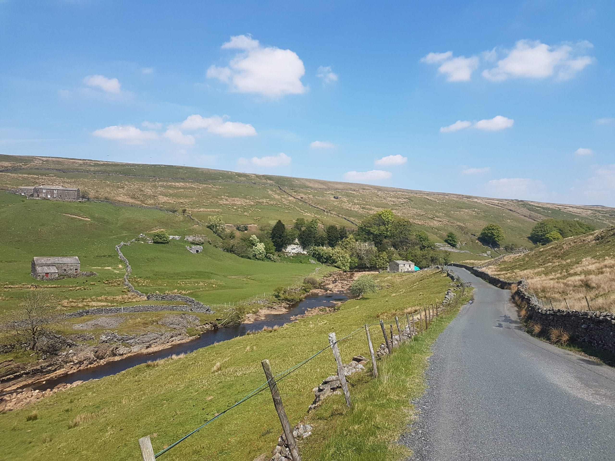
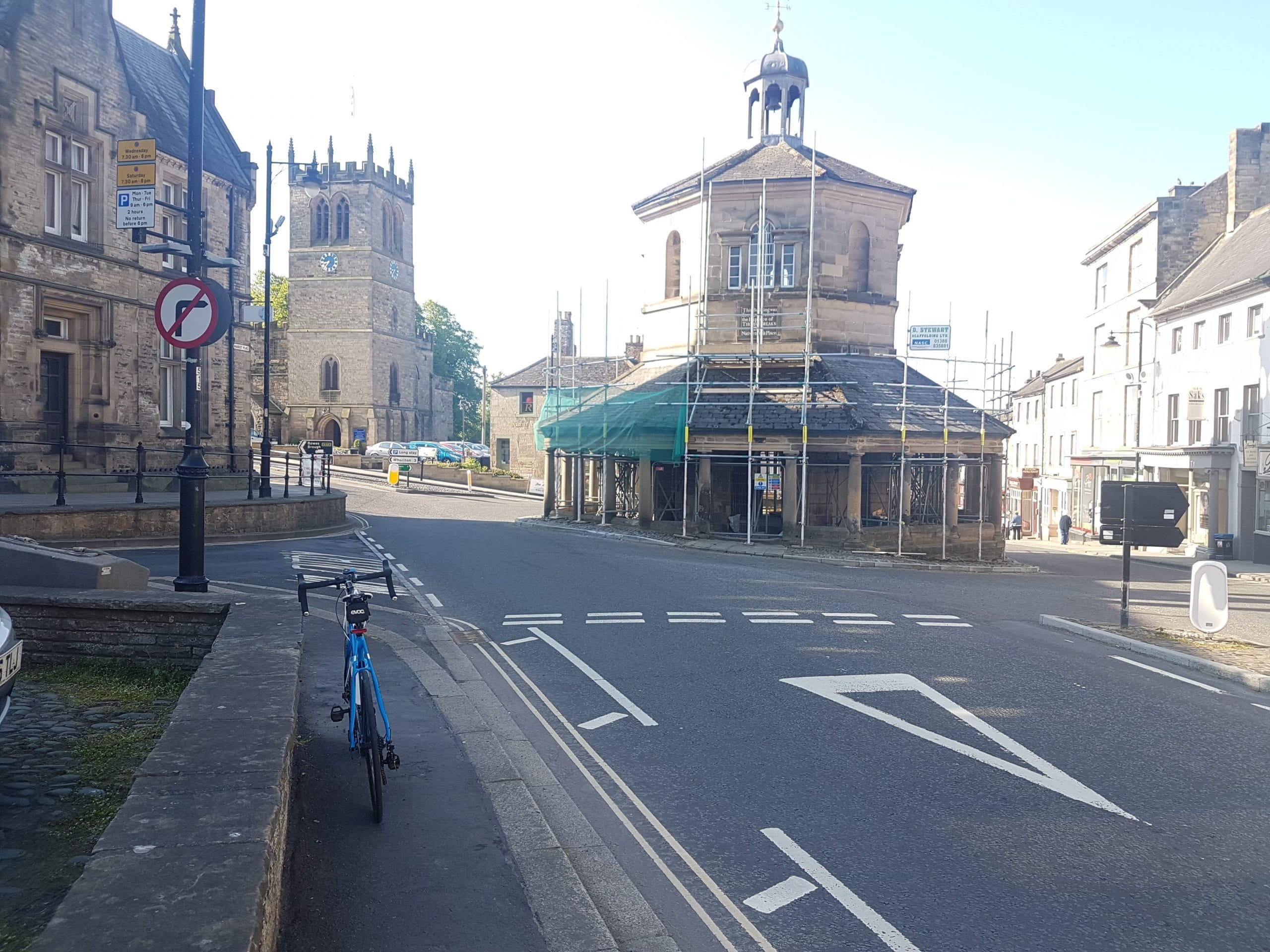
It’s hard for a cyclist to argue with five miles downhill cycling anywhere. Here, overlooking Teesdale, it would be impossible. I’m soon following cycle route signs through quiet residential streets to Barnard Castle’s bustling Horse Market.

The town has an impressive collection of traditional independent shops that still outnumber more recognisable chain stores. And its smattering of antique and collectable shops would get even the most reluctant of shoppers bargain hunting. But I’m here to see the sights and taste the delights, so I head for the sheltered bike parking offered by the Witham Arts Centre.

The Witham is the beating cultural heart of this rural market town. A fabulous not-for-profit enterprise, housing a gallery, gift shop, and versatile performance space that hosts famous comedians, folk music, live drama and other performances. Right in the middle of the Horsemarket, it’s great as a base for touring the town. And it has a busy cafe serving homemade food, good coffee and freshly baked cakes. What a fabulous place to stop.

Coffee and a sandwich in the Dispensary Cafe followed by a glorious slice of Victoria sandwich sets me up for the second half of the trip.

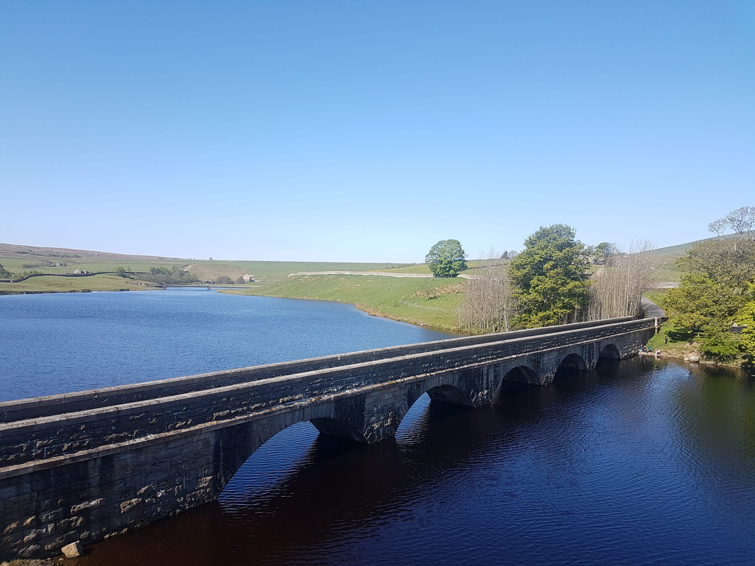
Barnard castle has a lot to offer and I can’t resist a little tour before setting off. Arriving in town from the east, you’d be forgiven for missing the castle at first. The entrance of the building that gives the town its name sits behind the Methodist Church at the bottom of Galgate. (Find the Post Office and look downhill). At the other end of the Market, the weather vane on the impressive Market Cross bears the scars of a local legend that says two men used it as the target in a contest to see which of them was the better shot. If the holes were made by the shots they fired, I’m not sure the matter was settled at all. And a mile and a half a loop out over the Tees to the eerie ruins of Egglestone Abbey.

Cycle route 165, takes me out of town past the the Bowes Museum, an unlikely French-style chateau purpose-built as a museum by John and Josephine Bowes in 1869, and on through Westwick, Whorlton, Little Newsham and South Cleatham.

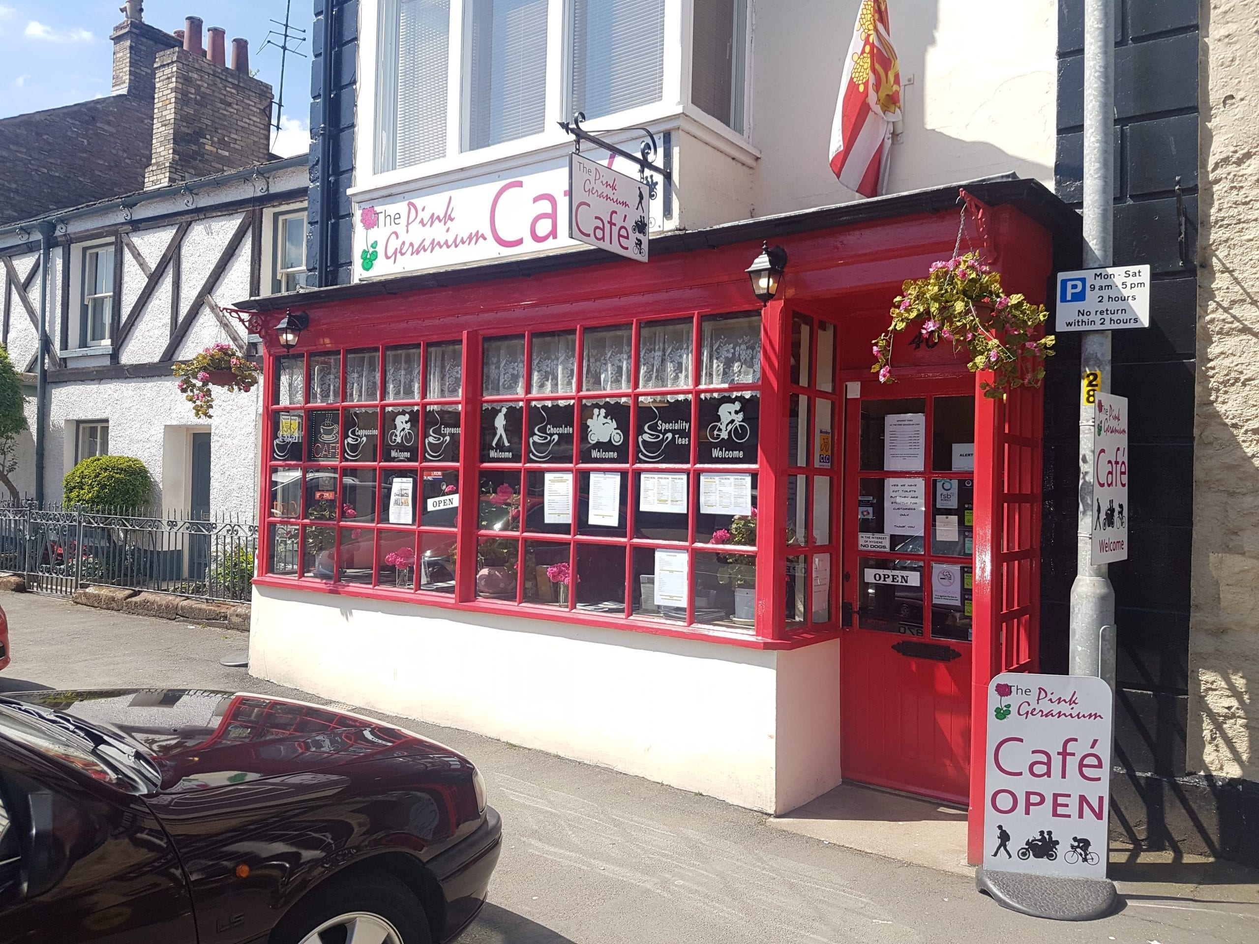
Nine miles from Barnard Castle, Staindrop village oozes medieval heritage. It’s pubs, post office, shop and cafes offer the chance for a breather before the final leg of the trip.

Out past the impressive St Mary’s Church at the eastern end of the village, the Darlington road takes me to the back lanes around Wackerfield and up to cross the A688 at the Sun Inn.

Descending into the Gaunless valley at Esperly, the farming landscape starts to include echoes of the area’s industrial heritage. A steep climb through Low Lands to High Lands and there are two miles of descent to enjoy before a one last climb up into Hamsterley village. A mile-long valedictory roll down to Bedburn and I’m back at Hamsterley Forest visitor centre.

This route is an extremely enjoyable 33-mile day out with mostly moderate hills. It is suitable for riders of all abilities with touring, gravel and mountain bikes.

Categories
Short Rides

Cycling with Sis

Getting back on your bike after a crash isn’t the easiest thing to do. I didn’t ride for three months after a crash on my mountain bike in 2012, then when I did get out there were riders with tassels and stabilizers who had more confidence than me. It took months of riding and eventually a new bike (any excuse!) to get my confidence and roadcraft back to useful levels.

It’s generally no more than a loss of confidence that takes time to rebuild. And sometime a push helps.

My sister got into cycling earlier this year and has been making really good progress, regularly getting out for 30 miles and more. A few weeks ago she hit the deck hard after a saddle bolt sheared and she lost her balance. She spent a few days in hospital with head and facial injuries and and assortment of scrapes bruises and other fractures – I thought some big-brother encouragement would help, even in middle agePicture of Paul and his sister, so I slung the bike on my new Saris Bones car rack and headed down to Wiltshire.

We started out in the pretty little village of Whiteparish on the edge of the New Forest National Park. A short stint on a very wet A27 through the village’s attractive mismatch of ivy-covered cottages and down a lane to cross the A36 into the Forest. Narrow, twisting lanes with high hedgerows, high banks and tall trees – the kind where a deer is likely to pop out at any point – took us to up to Redlynch. Wet lanes covered in grit and gravel washed out by the rain didn’t make ideal conditions for someone on their first ride after a crash, but she looked confident and I was probably more worried for her than she was.

Long, mostly level road out across the forest and the rain was really coming down. My sister complaining that her lack of bike time made her unfit. We joined the Fordingbridge to Cadnam road for a mile, it’s designated a B road, but is busy and treated like a trunk road by the traffic using it, so we cycled single file for the mile or so up to a crossroads where we turned back  to Nomansland down the hill Pipers Wait – steep and twisty, be warned – and on to Landford.

An unpleasant mile and a half on the A36 (the route suggested here is amended to avoid that) took us back to Common Road and into Whiteparish. A thoroughly enjoyable wet ride in lovely countryside.

The Book

Distance – 18 Miles

Profile – Easy: 550ft

Starting at All Saints Church in Whiteparish, take the 27 west through the village for 1/3 mile. Turn South on Newton Lane, cross A36 to Moor Lane and continue to the end. At The junction, turn right signposted Downton/Redlynch and follow the road to the top of Bowers Hill at Woodfalls; turn left. Follow the B3080 through Woodfalls and onto Forest Road towards Cadnam. Three miles to the junction with B3078 and go straight on for another mile to the crossroads at the top of the hill signposted Landford/Nomansland, turn left. Steep incline warning for the hill at Pipers Wait, through Nomansland past the Lamb Inn and to the crossroads signposted Salisbury/Lyndhurst. Turn Left (North) towards Landford. After a mile you’ll reach a junction signposted Hamptworth Golf and Country Club, turn left (West) and follow the road for three miles back to the junction signposted Whiteparish. Turn right (North) and retrace your path along MoorLane, across the A36 and Newton Lane to join the A27 back into Whiteparish.

Where to Park

We started in Whiteparish, because it was easy to get to from the A36. There’s plenty of on street parking and All Saints Church in the centre of the village has a large car park.

Places to eat

Whiteparish has the King’s Head and Parish Lantern pubs. Both serve food every day

Woodfalls Inn at Woodfalls near Redlynch on the route has a great menu and good coffee

The Lamb Inn at Nomansland serves a great menu and fabulous beer. Ample parking here makes it a good alternative start/finish point.

We started out with a flapjack and a coffee from the friendly people in Whiteparish Post Office across the road from the church.